In the Region of Timbuktu
this section is
still under construction please check back for
updates
Once you have made it all the way to Timbuktu you may want
to see more than just the town. If you have the time and
means you can take camel or car (4x4) to many locations.
Day
or two trip: With a 4x4 the locations below
can be reached and returned from in a day but if you want
to do a loop through several and really appreciate them,
you should count at least two days.
To
the West
Lake
Fagabine, once one of the largest
natural lakes in West Africa is now little more than a
dent in the ground. Formerly millet, wild wheat and corn
were grown along its banks as the water level changed
with the seasons. It is still very interesting to visit.
You can get there by heading North from Goundam or
Directly across the sand from Timbuktu. On its banks is
the old village of Farach which is all but abandoned,
white dunes of the north mix with red dunes of the
south. approaching the lake you will come upon the new
village of Farach. Tents are scattered and hidden among
the dunes and the vegetation on the strip near the lake.
Tomb
of the Giants These Neolithic sepultures are
the subject of myth and legend amongst the Tuareg who know
the occupants only as “the people from before” whose stone
tools are found scattered throughout the area. Some say
they were giants, ogres even, and many locals fear to
approach the tombs after dark.
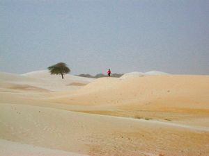 Essekane,
the site of the famous festival. The area has beautiful
white sand dunes, and some nearby mountains where if you
scrabble around you may find old artifacts in midden
mounds. Calculate a good three hours one way for the 70 km
trip. It is loose sand all the way.
The
three day festival was held annually in early January. It
was originally based on the traditional Tuareg gatherings
held each year by a different tribe. In deference to the
increased international participation and the complexities
of organisation a permanent festival site has been
developed. The festival has become more "touristy" but also
more easily accessible. For those looking to discover a bit
of local music, see camels and buy artisanal souvenirs, it
is perfect. For those wishing a more authentic nomad
experience you may be a bit disappointed. Still, the music
is excellent. In the last few years the festival has been
moved to the outskirts of Timbuktu. Though it may go back
to Essekane again. There is an entry fee that has been 120
euro in past years. The official festival website is
www.festival-au-desert.org
Zouara
The apprach to this
village has a huge open plain where it is possible to
observe many birds. The village has it’s market on
Tuesdays.
Tin
Aïcha.
Market day is Monday. Every year on the second day of the
end of Ramadan celebration, all the nomads in the region
gather here for the fete of the goats. The tradition is to
celebrate the arrival of the herds to lake Fagabine. It is
also an occasion for the men to show off. They dance their
camels to the rhythms of the women drumming on the tinnde,
a drum made of a morter covered with leather.
M’bouna
has architecture
typical of Timbuktu. The village bordered by trees is
snuggled amongst massive dunes. It has a beautiful mosque.
Lake
Fati The
sand is red, the lake bright blue with beautiful beaches.
The village of Fati is comprised of Bozo fishers, numerous
species being available in the lake.
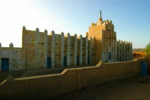 Goundam
is now easily
accessible on an improved gravel track. It is about
85km from the place where the road leaves Timbuktu.
The track is good enough that a speed of 80-90km/p/h
can be easily maintained for most of the track
(excepting stoping for livestock crossing). It takes
about an hour or hour and a half one way and you will
be coated with red dust from the imported gravel. The
town is an ancient post of the French Colonials and
some of the buildings remain. Also an interesting
mosque just behind the main market area is worth a
look. Buildings in the town are a mix of mud brick and
baked brick giving it a picturesque look. The market
is not very interesting, but the town is an important
agricultural centre and is situated on one edge of
Lake Tele.
Dire
About 35 km south
of Goundam, this port town is one of the regular stops for
the river traffic. It has an excellent weekly market on
Fridays.
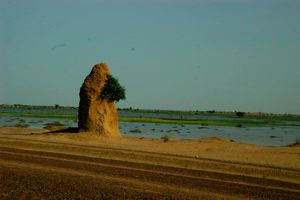 Tonka
is 35km west
of Goundam on the same gravel track. The countryside
en route is lovely and you can see lake Fati in the
distance and several small mountains rise up. The town
has a mix of all the ethnicities of the region who
gather each Sunday for the weekly market that is worth
seeing. Fuel is availbe here for those who have their
own car. Look for guys with a tray of glass bottles of
gas (for motorbikes) outside their shop; they will
also have 20L jugs of deasil fuel and a funel for you
vehicle. 600f/L.
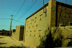 Niafunke
is situated on
the banks of the Niger river another 35km west of
Tonka. The road continuing to Niafunke is built mostly
on a dike due to annual flooding. The gravel track
also deteriorates noticably after leaving Tonka and
erosion gouges deep runnels in the dike that must be
carfully avoided. When the water receeds some there
are tracks leaving the main gravel route that are
smoother. There is a ferry boat to cross the river
here. you can find fuel and a pharmacy in town. There
are two options for lodging. The Hotel Campement
Niafunke which was formerly state owned and then sold
to private management. The Hotel Ali Farka Toure which
was formerly the guest house where this famous
musician lodged his visitors. His family has turned it
into a hotel. The courtyard opens directly onto the
river. In 2008 they offered the first edition of the
festival Ali Farka Toure. 6-8 November. There are some
nice white sand beaches on the Timbuktu side of the
town. The area south and west floods in the rainy
season.
Niafunke
is situated on
the banks of the Niger river another 35km west of
Tonka. The road continuing to Niafunke is built mostly
on a dike due to annual flooding. The gravel track
also deteriorates noticably after leaving Tonka and
erosion gouges deep runnels in the dike that must be
carfully avoided. When the water receeds some there
are tracks leaving the main gravel route that are
smoother. There is a ferry boat to cross the river
here. you can find fuel and a pharmacy in town. There
are two options for lodging. The Hotel Campement
Niafunke which was formerly state owned and then sold
to private management. The Hotel Ali Farka Toure which
was formerly the guest house where this famous
musician lodged his visitors. His family has turned it
into a hotel. The courtyard opens directly onto the
river. In 2008 they offered the first edition of the
festival Ali Farka Toure. 6-8 November. There are some
nice white sand beaches on the Timbuktu side of the
town. The area south and west floods in the rainy
season.
To
the north
A trip to one of the nearer
camps is
easily done but should be attempted only with a
knowledgeable local guide, preferably an adult and
real
Tuareg. It is very
rude to go blundering into someone's camp without proper
protocol. There are also a few actual villages.
Agouni
is 35 km north
along the route to Arouane and Taoudeni. It is picturesque
and flanked by enormous dunes. Count at least an hour to
get there.
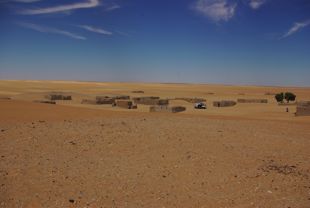
Asidi is a
friendly village whose two metal water towers attest to
some contact with the outside world. The school teacher is
open does his best from the one classroom in useable
condition of his three room school.
 Araouane
225 km north
of Timbuktu on the route of the salt caravans. (this
will require at least three days to vist in 4x4) Much
older than Timbuktu it was once a major oasis
containing many wells most all of which are now lost
in the sands of the encroaching dunes. One of the few
buildings to resist burial is the mosque built around
1593, which also houses the mosoleum of the saint
Cheikh Sid'Ahmed Agadda (1570-1640). Alphahou also
known as Araouane II is now almost completely burried
but its ruins can be seen peeking out of the sand 7km
from Araouane.
Araouane is historically and culturally very important to
the people of the region but is at risk of disapeaing and
taking its history (including thousands of manuscipts) with
it. An association of expatriates and sympathisers called
CADI (Association du Collectif d'Araouane pour le
Developpement Integre) has been esstablished to save the
site. Their objectivees are the promotion of socio-cultural
values, restauration of historic sites, preservation of
manuscripts, slowing the encroachment of the dunes, and
reduction of poverty by creating jobs for the residents
with integrated development porjects. For more information
about this society and its activities or to contribute to
the cause contact: email: cadiaraouane@gmail.com. tel:
(+223) 20 21 20 51 fax: (+223) 20 21 08 35.
To
the East
Ber,
one of the stops on
the direct route to Gao, is a small banco village in the
midst of dunes with little to recommend it, save a chance
to discover the flavour of the desert. It does however host
a bustling camel market on Tuesdays
Gourma-Rharous
Caravans heading
south must pass through this town. It is also a place to
cross the river and rejoin the pavement near Gosi or
Hombouri. The territory between Gourma-Rahous, Bambara
Moudie and Hombouri is called the Gourma and is part of a
reserve for the elephants. After the sandy bit leaving
Timbuktu the road is relatively hard along the Niger
flood-plain and driving is faster.
Gao It takes
a full day’s driving to reach Gao. Visit Gao's Bureau of
Tourism website at www.visitgaomali.com
To
the South and SouthEast
or
tips on
driving. There are now several
small camps settling themselves permanently along its
length which is a boon to travellers who may find
themselves in need of assistance, or a place to rest.
There are also some signs along the way pointing
to forage
(pump) a short
distance off the road. This is a place that you can find
water if you are in a real fix; you may also find a
person there watering animals whom you can ask for help
if you need it.
By
Land
The 200 km
“Route d’Espoire” from Timbuktu to Douenza where the
pavement leads to Gao or Mopti is very rough. You can learn
more of it on the pages on transport
Marmar is a
tiny “village” encampment only about 10km from the ferry
crossing for timbuktu on the south side of the river. It
has a concrete mosque, a Monday weekly market and a small
shop of staples if you need a break on the route
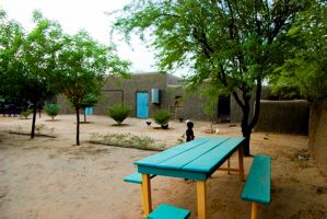 Tiboraghen
This is a
small village 32km from the ferry crossing for
Timbuktu. It has a camp called Ténéré started by the
original owner of the Amanar restaurant in Timbuktu.
The village is small but has a shop of basic staples.
Ténéré is nice with lots of open space and greenery.
It has running water via cisterns that the sun heats
to quite warm temperatures and solar electricity.
There are fully plumbed bathrooms and some rooms or
you can pitch you tent or just have a bed under the
open sky. It is a good option for people who, almost
to Timbuktu think they will not make the ferry in the
evening and do not wish to sleep on the river bank, or
conversely got an early eveing start out of Timbuktu
but do not want to continue of the rough road in the
dark of night.
Dar
Salam is
45-50km from the the river along the road to Douenza where
a dune is trying to overrun the road. Like many of the
small settlements along this road it is established by
nomads that have started to fix themselves around water
points as permanent settlements become the forced choice
for access to services and recognition. It has a mosque and
a couple of small shops selling the staple goods of the
region: tea and sugar, biscuits (cookies), powdered or
tinned milk, sardines, plastic flip-flops, flashlights
(torches) and batteries.
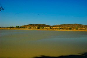 Bambara
Moudi Until recently the only
village on the tortuous “road of hope” between Douenza
and Timbuktu. It is the halfway point between the two
cites. There is a weekly market on Sundays. They do
have garage services, tire repare and fuel for sale.
There are now a number of shops right along the main
road that sell food and sometimes have cool beverages.
There is a restaurant and a place offering lodging.
This is also a place where you can head east to pass
several watering holes on the migration route of the
elephants. They are typically in this region during
the dry months.
Benzema.
The first watering
hole around which the elephants often gather in the winter
months.
In
Adiatafene A
second watering hole, again a possible sighting place for
elephants.
Hombori
is known for its
mountains which are great for rock climbing, the best known
being the Hand of Fatima. The mountains have lots of
cultural and religious significance as well, so aspiring
rock climbers should present themselves at the chief's
house (the chief closest to where your are going to climb)
and make sure the route you want to take is not infringing
on this. The climbing is vertical; you will need equipment,
though some can be rented locally.
It is also possible just to do some hiking in the area.
Count at least 5000 per person per day for guide, food and
porter services.
The villages in these mountains are mostly Songai and date
back to their flight from the invading Moroccains in the
16th century at the end of the Askia empire. They built
their villages high on the outcrops which made them more
defensible. the natural spings coming out of the mountains
further aided the resistance, providing drinking water and
irrigation. The defensiveness of their situation permitted
them to resist the French colonials up to 1924.
Gosi
a
Tin
Tadeini a
On the river
Koriome
is the port that
serves Timbuktu today. The two towns are connected by a
paved strip. From here you can observe the activity of the
port. The quay can be stacked with sacks of rice, oranges,
and other goods just unloaded or bars of salt waiting to
go. There is a small market and places you can get a
something to eat. the chief of the port transport
syndicate, Harber can help get you transport on the river.
This is also the location of the ferry that crosses the
river, though in the dry season it will be a little further
down stream. There will be stalls with food and beverages
at the other side of the ferry crossing too.
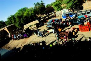 Kabara
is the former
port for Timbuktu. When the water is high the COMANAV
ferry still comes here instead of Koriome. From
Timbuktu head straight south on the pavement it will
turn to hardpacked track and carry you right to the
port. the Market faces the quay. you can often get
good deals on fruit and other imports that have been
off-loaded here before they get carted to Timbuktu.
Toya
you can rent a
pinasse and take a short trip to the Bozo village Toya
whose beautiful dunes come right down to the waters edge.
Historically Toya was the site of the 1736 battle between
the Tuareg and the Arma for control of Timbuktu’s port.
During high water it is virtually an island It takes about
2hrs by motor pirogue.
Houndou
Bomo Koyna A
songai village 12 kmfrom Korimome has a very active market
on Saturdays. Some time the hippopotami are seen in this
area. Count the greater part of a day to go visit and come
back.
Bourem
Inali is the
location where you are sure to see hippos. It is 22 km from
Koriome, and along the way you can observe Bozo and Sognai
villages. Monday is the weekly market which is quite
lively. A mix of herders, fishers, cultivators and artisans
all display their wares.